


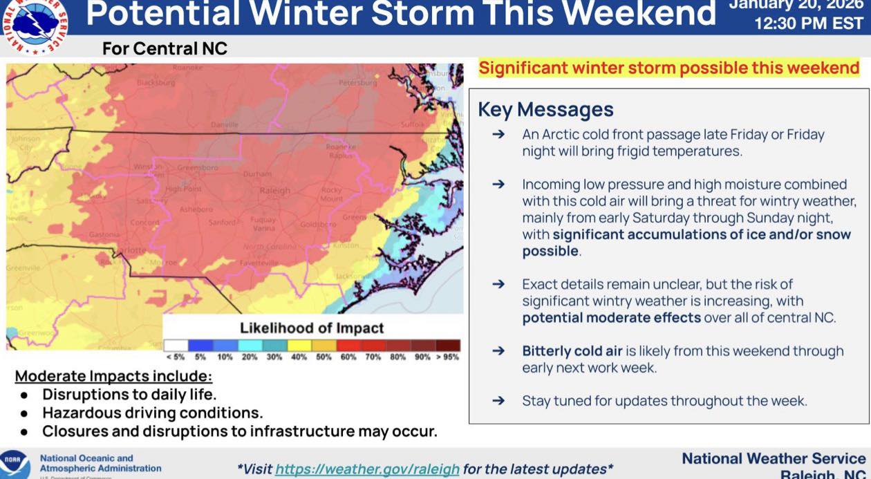
Cumberland County, NC — A calm and cold midweek pattern is expected to transition into a potentially impactful winter weather event by the weekend. While temperatures remain relatively mild through Thursday, a developing system could bring snow, sleet, and freezing rain to the region beginning late Friday night. Forecasters note that confidence is increasing this system could become significant, with potential impacts to travel and power across central North Carolina, including Cumberland County.
This Week’s Forecast Overview
Tonight will be clear and cold with a low near 21 degrees and calm winds. Wednesday is expected to be mostly sunny with a high near 51 degrees and light afternoon winds. Wednesday night will turn mostly cloudy with lows around 36 degrees. Thursday brings mostly sunny and mild conditions with highs near 59 degrees. Thursday night becomes cloudy with a 30 percent chance of rain after 1 a.m. and lows around 41 degrees.
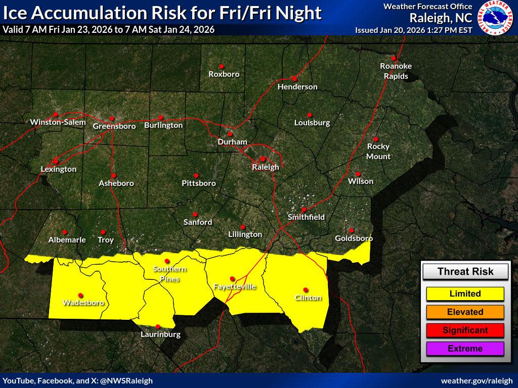
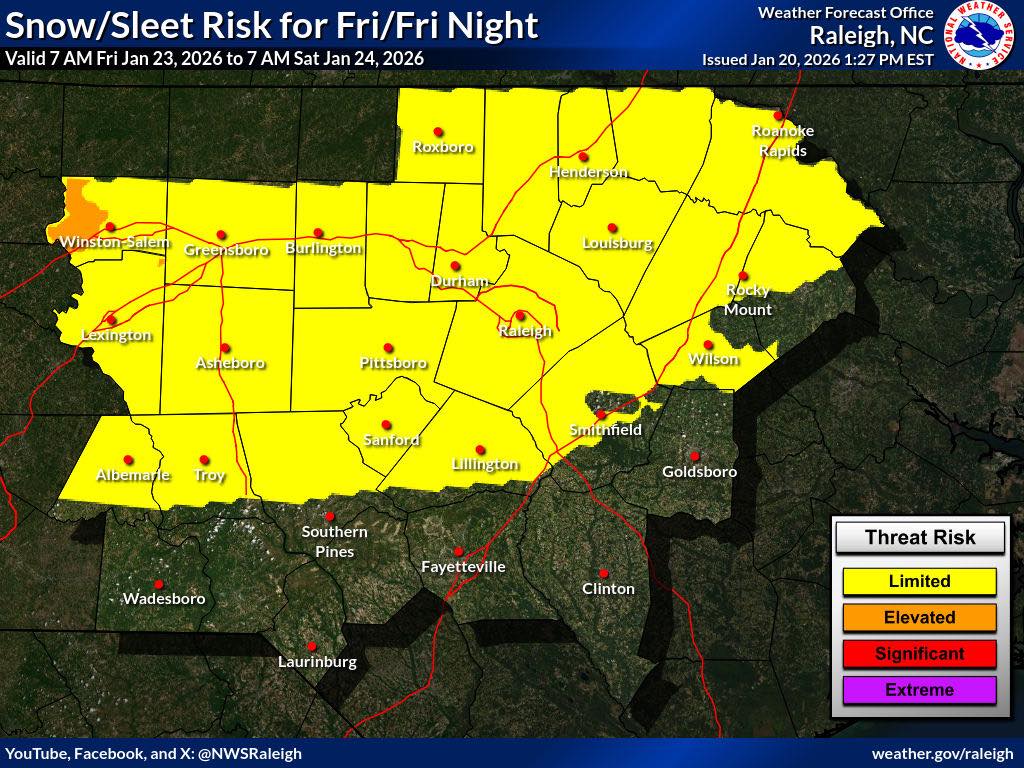
Rain is likely Friday, mainly before early afternoon, with highs near 53 degrees and rain chances around 60 percent. Conditions begin to change Friday night as temperatures drop to around 25 degrees, with a chance of rain transitioning to snow and freezing rain after 1 a.m.
Saturday carries a high risk for winter precipitation, with snow, sleet, and freezing rain possible and a high near 29 degrees. Saturday night is expected to remain cold, with freezing rain and sleet likely and possible snow mixed in, with lows near 20 degrees. Sunday continues the wintry pattern with more freezing rain and possible snow, highs near 30 degrees, and a high likelihood of precipitation. Sunday night remains cold with lingering chances of a wintry mix and lows near 20 degrees.
Hazards and Impacts
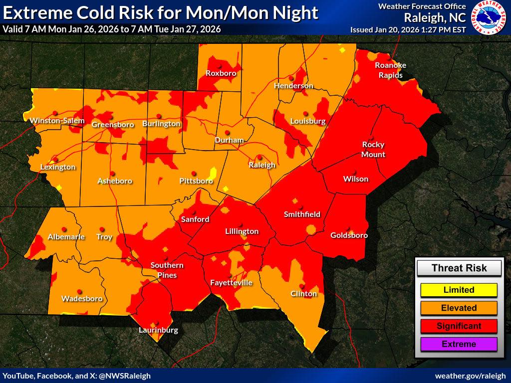
The National Weather Service warns that a potentially significant winter storm could affect central North Carolina this weekend. Ice and snow accumulations are possible from late Friday night through Sunday, creating hazardous travel conditions, especially on bridges and untreated roadways. Freezing rain may lead to scattered power outages. Very cold temperatures are expected early next week, with wind chills potentially near or below zero.
While exact timing and accumulation totals are still uncertain, the likelihood of impactful conditions is increasing as the forecast evolves.
Preparedness Recommendations
Residents are encouraged to prepare ahead of the weekend by charging phones and backup power banks, limiting non-essential travel if conditions deteriorate, checking heating systems and cold-weather supplies, and making plans for pets, older adults, and neighbors who may need assistance.
Updates will be shared as new and confirmed information becomes available.